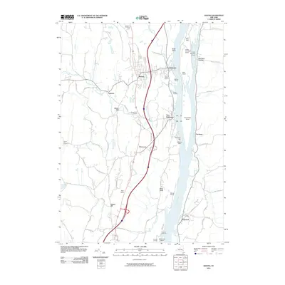
2010 Map of Ravena
USGS Topo · Published 2010About this map
Ravena and New Baltimore anchor this stretch of the Hudson River valley, where the landscape is defined by the braided channels and islands of the river. The map reveals a high concentration of small, family-named burial grounds like Waldron Cemetery, Chestnut Lawn Cemetery, and Requea Cemetery, which serve as vital markers for local genealogical research. The river itself is dotted with significant landforms such as Houghtaling Island and Bronck Island, while the Coxsackie Lighthouse stands as a navigational sentinel near the southern boundary. To the west, the terrain rises toward Roberts Hill and High Rocks, with smaller communities like Aquetuck and Deans Mill situated along the winding paths of Hannacroix Creek. This 2010 survey illustrates the continued importance of the river corridor, showing the proximity of the riverside rail line to historic centers like Schodack Landing and Stuyvesant.
Find a feature on this map
82 named features on this map. Tap any name to fly to it.
Don’t see what you’re looking for? This feature index may not catch every label — zoom into the map to look around manually.
Map Details
Editions of this 2010 Ravena Map
This is the sole edition of this map. No revisions or reprints were ever made.
Other maps of this area

1893 · Troy
USGS Topo · 1:62,500

1893 · Coxsackie
USGS Topo · 1:62,500

1893 · Albany
USGS Topo · 1:62,500

1894 · Coxsackie
USGS Topo · 1:62,500

1895 · Troy
USGS Topo · 1:62,500

1895 · Albany
USGS Topo · 1:62,500

1898 · Albany
USGS Topo · 1:62,500

1898 · Troy
USGS Topo · 1:62,500

1903 · Kinderhook
USGS Topo · 1:62,500

1925 · Troy
USGS Topo · 1:48,000