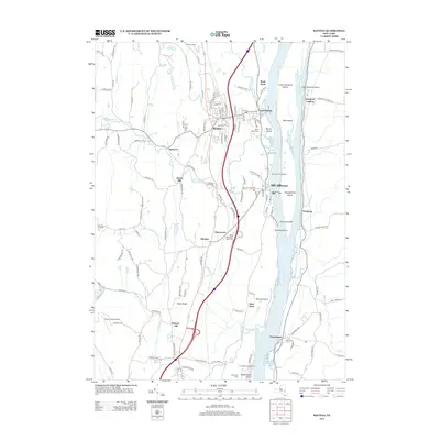
2013 Map of Ravena
USGS Topo · Published 2013About this map
Coeymans and Ravena sit at the heart of this landscape along the western banks of the Hudson River, where the river's path is defined by a complex chain of islands including Lower Schodack Island, Mull Island, and Houghtaling Island. This 2013 survey illustrates a region where local industry and transportation infrastructure meet the water, featuring the New Baltimore Rest Area and Shady Harbor Marina. The map is particularly useful for genealogical research, documenting numerous burial grounds such as Saint Patrick Cem, Chestnut Lawn Cem, and Waldron Cem. Small historic hamlets like Aquetuck and Albrights are preserved in their modern contexts, while the Coxsackie Lighthouse stands as a navigational landmark at the southern edge of the quadrangle. The topography transitions from the alluvial flats of the river valley toward the western heights of High Rocks and Roberts Hill, carved by Hannacroix Cr and Sickles Cr.
Find a feature on this map
131 named features on this map. Tap any name to fly to it.
Don’t see what you’re looking for? This feature index may not catch every label — zoom into the map to look around manually.
Map Details
Editions of this 2013 Ravena Map
This is the sole edition of this map. No revisions or reprints were ever made.
Other maps of this area

1893 · Troy
USGS Topo · 1:62,500

1893 · Coxsackie
USGS Topo · 1:62,500

1893 · Albany
USGS Topo · 1:62,500

1894 · Coxsackie
USGS Topo · 1:62,500

1895 · Troy
USGS Topo · 1:62,500

1895 · Albany
USGS Topo · 1:62,500

1898 · Albany
USGS Topo · 1:62,500

1898 · Troy
USGS Topo · 1:62,500

1903 · Kinderhook
USGS Topo · 1:62,500

1925 · Troy
USGS Topo · 1:48,000