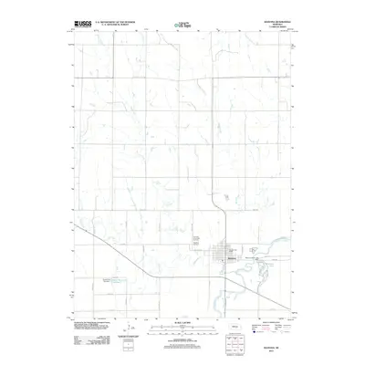
2011 Map of Ravenna
USGS Topo · Published 2011About this map
The South Loup River winds through this central Nebraska landscape, defining the southern portion of the area near the city of Ravenna. This 2011 survey illustrates the grid-based rural development typical of the region, where roads like 385th Rd and Carthage Rd partition the land around a network of waterways including Mud Creek, Beaver Creek, and Dry Creek. The community of Ravenna serves as the local hub, anchored by the Ravenna Post Office and surrounded by significant local landmarks such as Highland Cemetery and Our Lady of Lourdes Cemetery. To the southeast, the Ravenna Lake State Park and Ravenna Lake provide a clear view of the area's managed water resources, complemented by the Pease Reservoir Number 1 and its associated Pease Dam Number 1 located further west. The map offers a precise look at the early 21st-century infrastructure, including the State Hwy L 82A Link.
Find a feature on this map
22 named features on this map. Tap any name to fly to it.
Don’t see what you’re looking for? This feature index may not catch every label — zoom into the map to look around manually.
Map Details
Editions of this 2011 Ravenna Map
This is the sole edition of this map. No revisions or reprints were ever made.
Other maps of this area

1896 · Kearney
USGS Topo · 1:125,000

1896 · Wood River
USGS Topo · 1:125,000

1899 · Loup
USGS Topo · 1:125,000

1951 · Litchfield NE
USGS Topo · 1:24,000

1951 · Hazard
USGS Topo · 1:24,000

1953 · Rockville
USGS Topo · 1:24,000

1953 · Ravenna NW
USGS Topo · 1:24,000

1953 · Ashton
USGS Topo · 1:24,000

1953 · Ravenna
USGS Topo · 1:24,000

1955 · Broken Bow
USGS Topo · 1:250,000