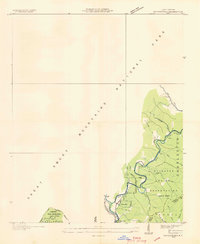
1936 Map of Ravensford
USGS Topo · Published 1936About this map
The Cherokee Indian Reservation defines this 1936 survey, which highlights the Qualla Tract and the community of Ravensford. This advance sheet, compiled from aerial photographs for the Tennessee Valley Authority, captures the area during the early development of the Great Smoky Mountains National Park. Settlement is concentrated along the river valleys, where the Oconaluftee River meets the Raven Fork. Local institutional life is marked by the presence of the Big Cove Sch and Piney Grove Ch, while numerous small watercourses like Sherrill Cove Branch and Pigeon Creek drain the surrounding slopes of Poplar Mountain Ridge. The mapping detail reflects a landscape in transition, where established tribal lands and small mountain homesteads began to border the expanding federal park system during the mid-1930s.
Find a feature on this map
31 named features on this map. Tap any name to fly to it.
Don’t see what you’re looking for? This feature index may not catch every label — zoom into the map to look around manually.
Map Details
Editions of this 1936 Ravensford Map
This is the sole edition of this map. No revisions or reprints were ever made.
Other maps of this area

1891 · Cowee
USGS Topo · 1:125,000

1893 · Mt Guyot
USGS Topo · 1:125,000

1897 · Cowee
USGS Topo · 1:125,000

1907 · Cowee
USGS Topo · 1:125,000

1912 · Mt Guyot
USGS Topo · 1:125,000

1933 · Bryson
USGS Topo · 1:62,500

1935 · Addie
USGS Topo · 1:24,000

1936 · Bunches Bald
USGS Topo · 1:24,000
1936 · Whittier
USGS Topo · 1:24,000
1936 · Bryson
USGS Topo · 1:24,000
Featured Places
- Birdtown Community, NC
- Painttown Community, NC
- Ravensford, Yellowhill Community
- Wolftown Community, NC
- Big Cove, Big Cove Community