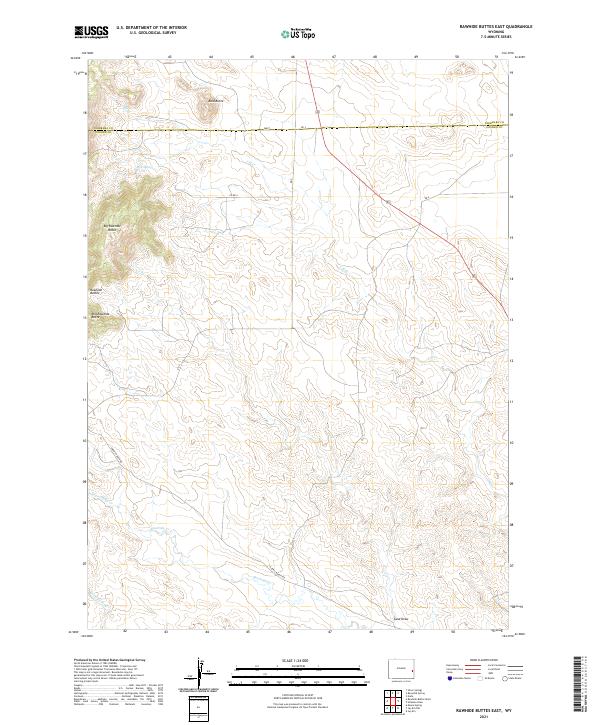
2021 Map of Rawhide Buttes East
USGS Topo · Published 2021About this map
Big Rawhide Butte and the surrounding Rawhide Buttes dominate this high plains landscape on the border of Goshen and Niobrara counties. The terrain is defined by a network of intermittent drainage systems and ephemeral draws, including Rawhide Cr and Sand Draw. Local ranching activity is evidenced by several named access roads like Harris Ranch Rd, providing a sense of the modern land use in this sparsely populated region.
Find a feature on this map
22 named features on this map. Tap any name to fly to it.
Don’t see what you’re looking for? This feature index may not catch every label — zoom into the map to look around manually.
Map Details
Editions of this 2021 Rawhide Buttes East Map
This is the sole edition of this map. No revisions or reprints were ever made.
Other maps of this area

1896 · Patrick
USGS Topo · 1:125,000

1896 · Hartville
USGS Topo · 1:125,000

1901 · Hartville
USGS Topo · 1:125,000

1951 · Moore Spring
USGS Topo · 1:24,000

1954 · Torrington
USGS Topo · 1:250,000

1958 · Torrington
USGS Topo · 1:250,000
1974 · Jay Em NW
USGS Topo · 1:24,000

1974 · Silver Springs
USGS Topo · 1:24,000

1974 · Jay Em
USGS Topo · 1:24,000

1974 · Rawhide Buttes East
USGS Topo · 1:24,000