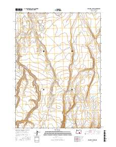
2017 Map of Rawhide Canyon
USGS Topo · Published 2017About this map
Wilson Cr carves through this high desert portion of Harney County, defining a landscape shaped by intermittent water sources and ranching infrastructure. This area is centered on Rawhide Canyon, where the drainage patterns of the Great Basin dictate the location of vital resources like Wilson Reservoir and the Bruce Waterhole. The map shows a transition from the north, where water is more readily captured, to the southern reaches of Mule Springs Valley. Navigated by a network of simple roads and trails including Rawhide Spring Rd and Warner Va, the region remains largely open range, organized by the township and range lines of the Public Land Survey System. The presence of these named water features highlights the essential nature of specific springs and catchments for managing livestock in an otherwise arid environment.
Find a feature on this map
14 named features on this map. Tap any name to fly to it.
Don’t see what you’re looking for? This feature index may not catch every label — zoom into the map to look around manually.
Map Details
Editions of this 2017 Rawhide Canyon Map
This is the sole edition of this map. No revisions or reprints were ever made.
Other maps of this area

1955 · Burns
USGS Topo · 1:250,000

1955 · Adel
USGS Topo · 1:250,000

1957 · Adel
USGS Topo · 1:250,000

1958 · Burns
USGS Topo · 1:250,000

1958 · Adel
USGS Topo · 1:250,000

1959 · Burns
USGS Topo · 1:250,000

1962 · Adel
USGS Topo · 1:250,000

1971 · Rock Camp Draw
USGS Topo · 1:24,000
1971 · Balls Lake
USGS Topo · 1:24,000
1971 · Red Bank Lakes
USGS Topo · 1:24,000