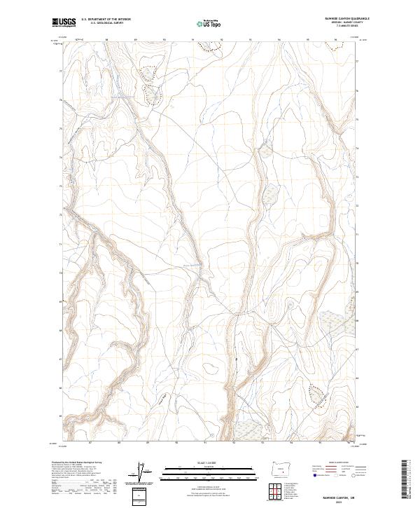
2023 Map of Rawhide Canyon
USGS Topo · Published 2023About this map
Wilson Creek drains through this high desert terrain in Harney County, feeding into the North Wilson Reservoir at the northern edge of the quadrangle. The landscape is defined by the elevation changes of Juniper Ridge and the winding path of Rawhide Canyon, which cuts through the volcanic geology typical of the Oregon outback. A network of primitive roads and trails provides access to this isolated area, including Rawhide Spring Rd and Warner Va. This survey documents a region where water management remains central to land use, highlighted by features like the Boyce Waterhole. The map illustrates the sparse infrastructure and large township sections characteristic of the public lands managed within the high plateau system of eastern Oregon.
Find a feature on this map
14 named features on this map. Tap any name to fly to it.
Don’t see what you’re looking for? This feature index may not catch every label — zoom into the map to look around manually.
Map Details
Editions of this 2023 Rawhide Canyon Map
This is the sole edition of this map. No revisions or reprints were ever made.
Other maps of this area

1955 · Burns
USGS Topo · 1:250,000

1955 · Adel
USGS Topo · 1:250,000

1957 · Adel
USGS Topo · 1:250,000

1958 · Burns
USGS Topo · 1:250,000

1958 · Adel
USGS Topo · 1:250,000

1959 · Burns
USGS Topo · 1:250,000

1962 · Adel
USGS Topo · 1:250,000

1971 · Rock Camp Draw
USGS Topo · 1:24,000
1971 · Balls Lake
USGS Topo · 1:24,000
1971 · Red Bank Lakes
USGS Topo · 1:24,000