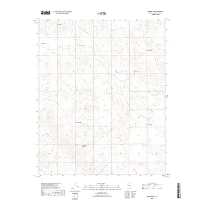
2018 Map of Rawhide Wash
USGS Topo · Published 2018About this map
Rawhide Mountains define the southern landscape of this Mohave County quadrangle, where the arid terrain is carved by a network of seasonal drainages and high peaks. The topography is dominated by dramatic elevation changes, from the heights of Potts Mtn and Fools Peak to the broad expanse of the Ester Basin. This desert environment is shaped by significant watercourses including the Rawhide Wash, Mississippi Wash, and Maggie Wash, which weave through the complex geology of the Mojave Desert. The presence of Co Hwy 15 provides the primary transit corridor through this sparsely settled region, connecting the rugged heights of Miller Mtn with the deep contours of Maggie Canyon. The map reveals a land defined by its natural drainage patterns and the stark verticality of its namesake mountain ranges.
Find a feature on this map
17 named features on this map. Tap any name to fly to it.
Don’t see what you’re looking for? This feature index may not catch every label — zoom into the map to look around manually.
Map Details
Editions of this 2018 Rawhide Wash Map
This is the sole edition of this map. No revisions or reprints were ever made.
Other maps of this area

1923 · Signal
USGS Topo · 1:250,000

1942 · Signal
USGS Topo · 1:250,000

1950 · Prescott
USGS Topo · 1:250,000

1954 · Prescott
USGS Topo · 1:250,000

1958 · Prescott
USGS Topo · 1:250,000

1959 · Prescott
USGS Topo · 1:250,000

1960 · Prescott
USGS Topo · 1:250,000

1965 · Prescott
USGS Topo · 1:250,000
1966 · Swansea
USGS Topo · 1:62,500

1966 · Ives Peak
USGS Topo · 1:62,500