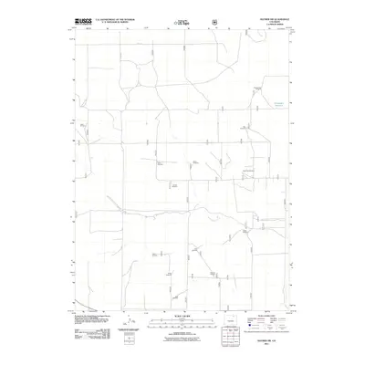
2011 Map of Raymer NW
USGS Topo · Published 2011About this map
Wild Horse Creek meanders across this high plains landscape in Weld County, defining a drainage pattern in an area where water management is central to the land's utility. The dominance of livestock and ranching is evident through the naming of numerous water-pumping landmarks, including Cattail Windmill, Greasewood Windmill, and Coyote Windmill. These specific labels often reflect the surnames of local families or descriptive features of the immediate terrain.
Find a feature on this map
17 named features on this map. Tap any name to fly to it.
Don’t see what you’re looking for? This feature index may not catch every label — zoom into the map to look around manually.
Map Details
Editions of this 2011 Raymer NW Map
This is the sole edition of this map. No revisions or reprints were ever made.
Other maps of this area

1954 · Sterling
USGS Topo · 1:250,000

1954 · Greeley
USGS Topo · 1:250,000

1957 · Greeley
USGS Topo · 1:250,000

1958 · Greeley
USGS Topo · 1:250,000

1958 · Sterling
USGS Topo · 1:250,000

1961 · Greeley
USGS Topo · 1:250,000

1964 · Greeley
USGS Topo · 1:250,000

1965 · Greeley
USGS Topo · 1:250,000
1972 · Keota SE
USGS Topo · 1:24,000
1972 · Keota
USGS Topo · 1:24,000