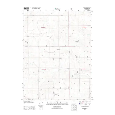
2013 Map of Raymer NW
USGS Topo · Published 2013About this map
Pawnee National Grassland dominates this expanse of the high plains in Weld County, revealing a landscape defined by water management and ranching infrastructure. The drainage of Wild Horse Creek winds through the center of the sheet, providing a natural focal point for the surrounding terrain. To the northeast, the Bringleson Reservoir stands as a significant hydrological feature, serving the agricultural needs of the region.
Find a feature on this map
38 named features on this map. Tap any name to fly to it.
Don’t see what you’re looking for? This feature index may not catch every label — zoom into the map to look around manually.
Map Details
Editions of this 2013 Raymer NW Map
This is the sole edition of this map. No revisions or reprints were ever made.
Other maps of this area

1954 · Sterling
USGS Topo · 1:250,000

1954 · Greeley
USGS Topo · 1:250,000

1957 · Greeley
USGS Topo · 1:250,000

1958 · Greeley
USGS Topo · 1:250,000

1958 · Sterling
USGS Topo · 1:250,000

1961 · Greeley
USGS Topo · 1:250,000

1964 · Greeley
USGS Topo · 1:250,000

1965 · Greeley
USGS Topo · 1:250,000
1972 · Keota SE
USGS Topo · 1:24,000
1972 · Keota
USGS Topo · 1:24,000