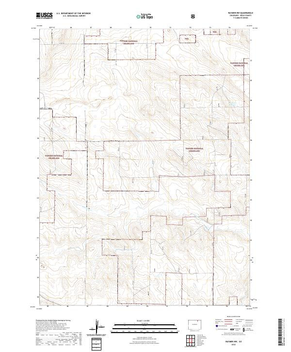
2022 Map of Raymer NW
USGS Topo · Published 2022About this map
Pawnee National Grassland dominates this corner of Weld County, preserving a vast expanse of the high plains as they appeared in the early 21st century. The landscape is defined by its subtle drainage patterns and occasional water management features, most notably Bringleson Reservoir in the northeastern section of the quadrangle. Intermittent waterways like Wild Horse Cr snake across the terrain, illustrating the precarious nature of water in this semi-arid environment. The mapping detail highlights the section lines of the Public Land Survey System, including townships t9n r59w and t8n r58w, which continue to dictate the placement of rural infrastructure. Remote travel through these grasslands relies on a sparse grid of maintained routes such as Co Rd 104 and Co Rd 115, which serve the isolated ranching and conservation interests of the region.
Find a feature on this map
9 named features on this map. Tap any name to fly to it.
Don’t see what you’re looking for? This feature index may not catch every label — zoom into the map to look around manually.
Map Details
Editions of this 2022 Raymer NW Map
This is the sole edition of this map. No revisions or reprints were ever made.
Other maps of this area

1954 · Sterling
USGS Topo · 1:250,000

1954 · Greeley
USGS Topo · 1:250,000

1957 · Greeley
USGS Topo · 1:250,000

1958 · Greeley
USGS Topo · 1:250,000

1958 · Sterling
USGS Topo · 1:250,000

1961 · Greeley
USGS Topo · 1:250,000

1964 · Greeley
USGS Topo · 1:250,000

1965 · Greeley
USGS Topo · 1:250,000
1972 · Keota SE
USGS Topo · 1:24,000
1972 · Keota
USGS Topo · 1:24,000