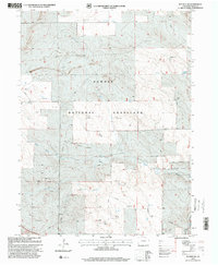
1997 Map of Raymer NW
USGS Topo · Published 2000About this map
Pawnee National Grassland dominates this high plains landscape in Weld County, revealing a specialized infrastructure built around water access and national defense during the late 20th century. The terrain is defined by the ephemeral Wild Horse Creek and a dense network of water features critical for ranching, including the Bringleson Reservoir, Side Hill Well, and numerous family or site-named landmarks like the Rauth Windmill and Motis Windmill.
Find a feature on this map
29 named features on this map. Tap any name to fly to it.
Don’t see what you’re looking for? This feature index may not catch every label — zoom into the map to look around manually.
Map Details
Editions of this 1997 Raymer NW Map
This is the sole edition of this map. No revisions or reprints were ever made.
Other maps of this area

1954 · Sterling
USGS Topo · 1:250,000

1954 · Greeley
USGS Topo · 1:250,000

1957 · Greeley
USGS Topo · 1:250,000

1958 · Greeley
USGS Topo · 1:250,000

1958 · Sterling
USGS Topo · 1:250,000

1961 · Greeley
USGS Topo · 1:250,000

1964 · Greeley
USGS Topo · 1:250,000

1965 · Greeley
USGS Topo · 1:250,000
1972 · Keota SE
USGS Topo · 1:24,000
1972 · Keota
USGS Topo · 1:24,000