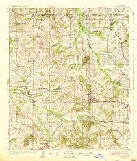
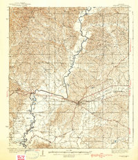
1937 Map of Raymond
USGS Topo · Published 1937About this map
Raymond and Clinton serve as central anchors in this mid-1930s landscape, which is defined by a dense network of rural educational and religious institutions. The presence of Hinds Junior College in the south and Mississippi College in the east highlights the region's academic foundations. Outside the towns, the terrain is dotted with local landmarks like the Old Mens Home and Kickapoo Camp, alongside numerous family-named schools such as Johnson Line Sch and Herring Sch No 2.
Find a feature on this map
70 named features on this map. Tap any name to fly to it.
Don’t see what you’re looking for? This feature index may not catch every label — zoom into the map to look around manually.
Map Details
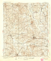
Editions of this 1937 Raymond Map
2 editions found
Other maps of this area

1903 · Jackson
USGS Topo · 1:125,000

1905 · Jackson
USGS Topo · 1:48,000

1906 · Florence
USGS Topo · 1:62,500

1908 · Jackson
USGS Topo · 1:62,500

1908 · Florence
USGS Topo · 1:62,500
1934 · Raymond
USGS Topo · 1:48,000
1937 · Terry
USGS Topo · 1:48,000
1938 · Edwards
USGS Topo · 1:62,500
1940 · Mechanicsburg
USGS Topo · 1:62,500
1942 · Raymond
USGS Topo · 1:62,500