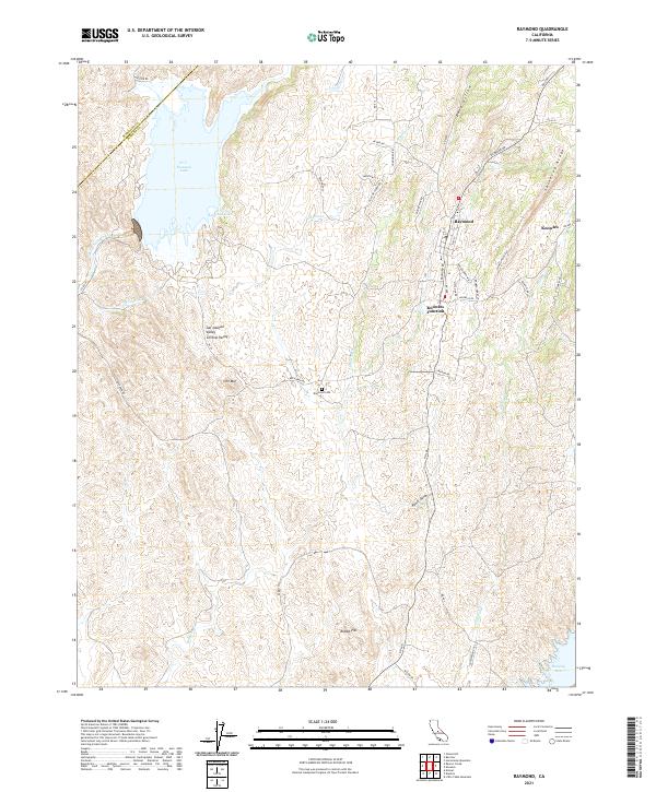
2021 Map of Raymond
USGS Topo · Published 2021About this map
Raymond and its neighboring settlements of Knowles and Knowles Junction anchor this part of Madera County, reflecting a landscape defined by the Sierra Nevada foothills. The terrain transition is evident where the San Joaquin Valley Central Valley meets prominent elevations like Iron Mtn and Spine-up Ridge. Water management is a central theme, with the Chowchilla River feeding into H. V. Eastman Lake at the western edge, while Hensley Lake occupies the southeastern corner. Local landmarks such as the Raymond Cem and geographic features like Rawls Gulch and Rabbit Hill provide specific points of interest for genealogical and local history research. The road network, including names like Granite Rd and Quarry Rd, hints at the area's geological and industrial character.
Find a feature on this map
49 named features on this map. Tap any name to fly to it.
Don’t see what you’re looking for? This feature index may not catch every label — zoom into the map to look around manually.
Map Details
Editions of this 2021 Raymond Map
This is the sole edition of this map. No revisions or reprints were ever made.
Other maps of this area

1912 · Mariposa
USGS Topo · 1:125,000

1919 · Indian Gulch
USGS Topo · 1:48,000

1919 · Raynor Creek
USGS Topo · 1:31,680

1919 · Little Table Mountain
USGS Topo · 1:31,680

1920 · Indian Gulch
USGS Topo · 1:62,500

1920 · Kismet
USGS Topo · 1:31,680

1921 · Daulton
USGS Topo · 1:31,680

1942 · Raymond
USGS Topo · 1:62,500

1942 · Daulton
USGS Topo · 1:24,000

1942 · Little Table Mountain
USGS Topo · 1:24,000