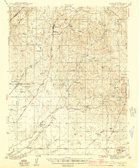
1944 Map of Raymond
USGS Topo · Published 1944About this map
The Southern Pacific RR terminates at Raymond in this 1940s study of the Madera County foothills, highlighting a landscape defined by ranching and resource extraction. The area around Knowles and the Madera Granite Quarry reflects the local industry that once fueled construction across the state. In the southern half of the quadrangle, the Fresno River and Cottonwood Creek wind through a territory dotted with family-held holdings such as Adobe Ranch and Shannon Ranch. The presence of the San Joaquin Experimental Range and the Daulton Copper Mine suggests a transition from traditional grazing to more specialized land use. Historical waypoints like Bates Station and Sixmile House offer insights into early transit patterns along Madera Road before the modernization of the California highway system.
Find a feature on this map
79 named features on this map. Tap any name to fly to it.
Don’t see what you’re looking for? This feature index may not catch every label — zoom into the map to look around manually.
Map Details
Editions of this 1944 Raymond Map
2 editions found

Other maps of this area

1912 · Mariposa
USGS Topo · 1:125,000

1916 · Sulphur Springs
USGS Topo · 1:24,000

1919 · Indian Gulch
USGS Topo · 1:48,000

1919 · Sulphur Springs
USGS Topo · 1:31,680

1919 · Raynor Creek
USGS Topo · 1:31,680

1919 · Little Table Mountain
USGS Topo · 1:31,680

1920 · Indian Gulch
USGS Topo · 1:62,500

1920 · Kismet
USGS Topo · 1:31,680

1921 · Daulton
USGS Topo · 1:31,680

1922 · Lanes Bridge
USGS Topo · 1:31,680