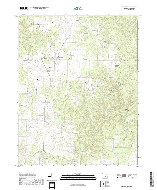
2021 Map of Raymondville
USGS Topo · Published 2021About this map
Raymondville and the smaller community of Yukon serve as the primary hubs in this portion of Texas County, situated on the Salem Plateau. The landscape is deeply incised by a series of hollows, including Flat Rock Hollow, Gregory Hollow, and Devils Hollow, which define the local drainage patterns toward Big Cr and its tributaries like Hobbs Br. Local history is anchored by the Friendship Cem and Allen Cem, providing vital reference points for genealogists tracing families in this rural Ozark district. The topography is also notable for the Bradford Cave Hollow and the Bear Claw Spring, reflecting the karst-influenced geology of the region. A dense network of county roads, such as Co RD 3320 and Co RD 3410, connects isolated homesteads and farmland, while State Rte B serves as the main east-west artery through the settlement at Raymondville.
Find a feature on this map
101 named features on this map. Tap any name to fly to it.
Don’t see what you’re looking for? This feature index may not catch every label — zoom into the map to look around manually.
Map Details
Editions of this 2021 Raymondville Map
This is the sole edition of this map. No revisions or reprints were ever made.
Other maps of this area

1932 · Cedar Grove
USGS Topo · 1:48,000

1945 · Clear Springs
USGS Topo · 1:62,500

1946 · Summersville
USGS Topo · 1:62,500

1948 · Clear Springs
USGS Topo · 1:62,500

1948 · Summersville
USGS Topo · 1:62,500

1949 · Rolla
USGS Topo · 1:250,000

1951 · Montauk
USGS Topo · 1:24,000

1951 · Licking
USGS Topo · 1:24,000

1951 · Raymondville
USGS Topo · 1:24,000

1951 · Prescott
USGS Topo · 1:24,000