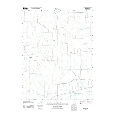
2012 Map of Rayville
USGS Topo · Published 2012About this map
Rayville and the surrounding Ray County countryside are defined by the intricate branching of the Crooked River and its various forks. This landscape is a patchwork of small agricultural holdings and rural settlements like Swanwick and Elkhorn, which are interconnected by a grid of numbered section roads and named lanes such as Bohrer Ln and Turnage Rd. The area maintains its rural character with several historical points of interest, including the centrally located Oggs Mill along the West Fork Crooked River.
Find a feature on this map
82 named features on this map. Tap any name to fly to it.
Don’t see what you’re looking for? This feature index may not catch every label — zoom into the map to look around manually.
Map Details
Editions of this 2012 Rayville Map
This is the sole edition of this map. No revisions or reprints were ever made.
Other maps of this area

1889 · Lexington
USGS Topo · 1:125,000

1894 · Independence
USGS Topo · 1:125,000

1935 · Buckner
USGS Topo · 1:24,000

1949 · Lexington West
USGS Topo · 1:24,000

1950 · Kansas City
USGS Topo · 1:250,000
1950 · Camden
USGS Topo · 1:24,000
1950 · Lexington West
USGS Topo · 1:24,000
1951 · Camden
USGS Topo · 1:24,000

1953 · Moberly
USGS Topo · 1:250,000

1954 · Kansas City
USGS Topo · 1:250,000