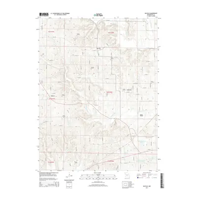
2014 Map of Rayville
USGS Topo · Published 2014About this map
Rayville sits at the heart of this Ray County landscape, where the agricultural character of the region is defined by a dense network of country roads and the winding paths of the W Fork Crooked River and Willow Cr. The area is notably rich in genealogical sites, with numerous family-named burial grounds like McGaugh Cemetery, Crowley Cemetery, and Sanderson Cemetery scattered across the township lines. Smaller historic nodes such as Elkhorn, Swanwick, and Saint Cloud are linked by thoroughfares including Strawberry Rd and Bathgate Rd. In the southern portion, water management is evident through several named reservoirs, including Swofford Lake and the Vandiver and Barchers Number A-2 Reservoir. This 2014 survey documents the persistence of these early rural settlements and their associated family landmarks well into the modern era.
Find a feature on this map
89 named features on this map. Tap any name to fly to it.
Don’t see what you’re looking for? This feature index may not catch every label — zoom into the map to look around manually.
Map Details
Editions of this 2014 Rayville Map
This is the sole edition of this map. No revisions or reprints were ever made.
Other maps of this area

1889 · Lexington
USGS Topo · 1:125,000

1894 · Independence
USGS Topo · 1:125,000

1935 · Buckner
USGS Topo · 1:24,000

1949 · Lexington West
USGS Topo · 1:24,000

1950 · Kansas City
USGS Topo · 1:250,000
1950 · Camden
USGS Topo · 1:24,000
1950 · Lexington West
USGS Topo · 1:24,000
1951 · Camden
USGS Topo · 1:24,000

1953 · Moberly
USGS Topo · 1:250,000

1954 · Kansas City
USGS Topo · 1:250,000