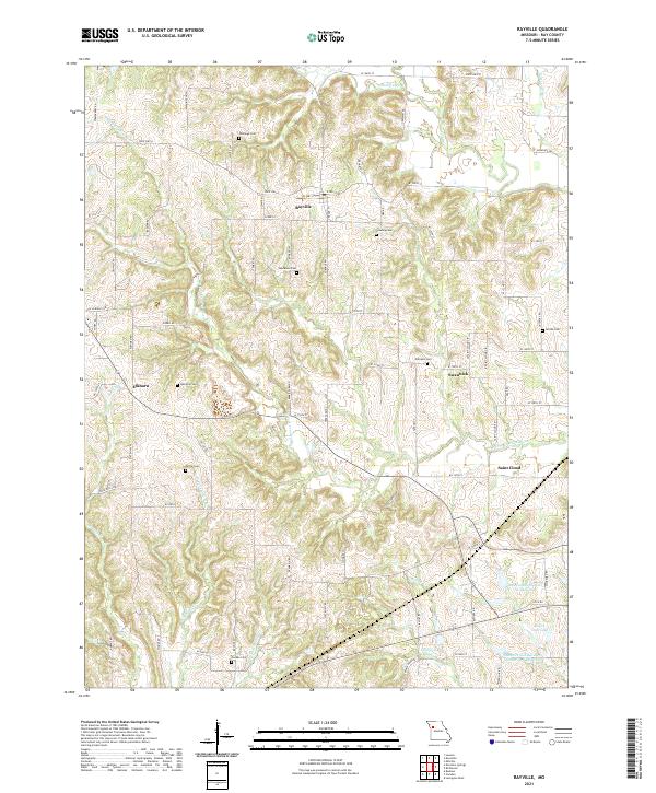
2021 Map of Rayville
USGS Topo · Published 2021About this map
Rayville sits at the center of this Missouri landscape, where the headwaters of the W Fork Crooked River and Rocky Fork carve a dendritic pattern through the terrain. The map captures a primarily agricultural region defined by small, dispersed settlements like Elkhorn, Swanwick, and Saint Cloud. Researchers will find a high density of rural burial grounds, including the McGaugh Cem, Crowley Cem, and Sanderson Cem, which often point to the locations of earlier farmsteads and pioneer families in Ray County. To the south, the landscape shifts toward managed water resources with Swofford Lake and the Ray County Number A-24b Lake. The road network, including State Hwy U and State Hwy FF, follows the natural ridgelines and drainage divides, illustrating how the local geography dictated early transportation routes and subsequent township development.
Find a feature on this map
86 named features on this map. Tap any name to fly to it.
Don’t see what you’re looking for? This feature index may not catch every label — zoom into the map to look around manually.
Map Details
Editions of this 2021 Rayville Map
This is the sole edition of this map. No revisions or reprints were ever made.
Other maps of this area

1889 · Lexington
USGS Topo · 1:125,000

1894 · Independence
USGS Topo · 1:125,000

1935 · Buckner
USGS Topo · 1:24,000

1949 · Lexington West
USGS Topo · 1:24,000

1950 · Kansas City
USGS Topo · 1:250,000
1950 · Camden
USGS Topo · 1:24,000
1950 · Lexington West
USGS Topo · 1:24,000
1951 · Camden
USGS Topo · 1:24,000

1953 · Moberly
USGS Topo · 1:250,000

1954 · Kansas City
USGS Topo · 1:250,000