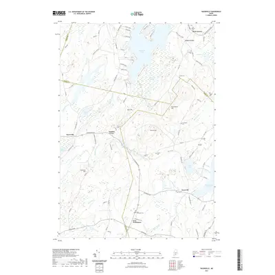
2021 Map of Razorville
USGS Topo · Published 2021About this map
Sheepscot Pond and the headwaters of the Sheepscot River dominate this interior Maine landscape, where the borders of Kennebec, Waldo, Lincoln, and Knox counties converge. The terrain is defined by a series of prominent rises including Cunningham Mtn, Patrick Mtn, and Crummett Mtn, which separate the various brook and pond systems. Settlement patterns follow the winding roads through the valleys, connecting small hubs like Razorville and West Washington.
Find a feature on this map
94 named features on this map. Tap any name to fly to it.
Don’t see what you’re looking for? This feature index may not catch every label — zoom into the map to look around manually.
Map Details
Editions of this 2021 Razorville Map
This is the sole edition of this map. No revisions or reprints were ever made.
Other maps of this area

1893 · Vassalboro
USGS Topo · 1:62,500

1893 · Wiscasset
USGS Topo · 1:62,500

1898 · Vassalboro
USGS Topo · 1:62,500

1913 · Waldoboro
USGS Topo · 1:48,000

1915 · Waldoboro
USGS Topo · 1:62,500

1916 · Liberty
USGS Topo · 1:62,500

1941 · Waldoboro
USGS Topo · 1:62,500

1941 · Vassalboro
USGS Topo · 1:62,500

1942 · Liberty
USGS Topo · 1:62,500

1943 · Vassalboro
USGS Topo · 1:62,500