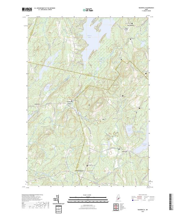
2024 Map of Razorville
USGS Topo · Published 2024About this map
The Lincoln and Knox County boundary runs through a landscape defined by glacial ponds and ridges in this 2024 survey. Small settlements like Razorville and West Washington anchor a network of rural roads that connect family-named landmarks and historic burying grounds. The geography is characterized by prominent elevations including Patrick Mtn and Cunningham Mtn, which overlook significant water bodies such as Sheepscot Pond and Washington Pond. Genealogists will find a high density of rural cemeteries, including the Marr Cem near Muddy Pond and the West Washington Cem along Rte 206. This modern topographic study records the persistent rural character of the region, where waterways like Davis Stream and Little Medomak Brook still dictate the flow of local travel and land use.
Find a feature on this map
94 named features on this map. Tap any name to fly to it.
Don’t see what you’re looking for? This feature index may not catch every label — zoom into the map to look around manually.
Map Details
Editions of this 2024 Razorville Map
This is the sole edition of this map. No revisions or reprints were ever made.
Other maps of this area

1893 · Vassalboro
USGS Topo · 1:62,500

1893 · Wiscasset
USGS Topo · 1:62,500

1898 · Vassalboro
USGS Topo · 1:62,500

1913 · Waldoboro
USGS Topo · 1:48,000

1915 · Waldoboro
USGS Topo · 1:62,500

1916 · Liberty
USGS Topo · 1:62,500

1941 · Waldoboro
USGS Topo · 1:62,500

1941 · Vassalboro
USGS Topo · 1:62,500

1942 · Liberty
USGS Topo · 1:62,500

1943 · Vassalboro
USGS Topo · 1:62,500