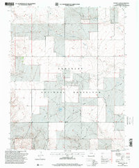
1996 Map of Reader Lake
USGS Topo · Published 2000About this map
Comanche National Grassland dominates this corner of Baca County, where the high plains are carved by a complex network of ephemeral drainage systems. The landscape is defined by the convergence of the North Fork Sand Arroyo, South Fork Sand Arroyo, and Middle Fork Sand Arroyo, which together trace the arid hydrology of the region. A solitary grave near the center of the sheet serves as a poignant reminder of the early homesteaders who attempted to cultivate this demanding environment.
Find a feature on this map
20 named features on this map. Tap any name to fly to it.
Don’t see what you’re looking for? This feature index may not catch every label — zoom into the map to look around manually.
Map Details
Editions of this 1996 Reader Lake Map
This is the sole edition of this map. No revisions or reprints were ever made.
Other maps of this area

1891 · Springfield
USGS Topo · 1:125,000

1892 · Mt Carrizo
USGS Topo · 1:125,000

1893 · Springfield
USGS Topo · 1:125,000

1955 · La Junta
USGS Topo · 1:250,000

1958 · La Junta
USGS Topo · 1:250,000

1968 · La Junta
USGS Topo · 1:250,000

1978 · Edler
USGS Topo · 1:24,000
1978 · Furnish Canyon East
USGS Topo · 1:24,000

1978 · Pritchett
USGS Topo · 1:24,000

1978 · Utleyville
USGS Topo · 1:24,000