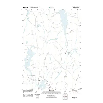
2011 Map of Readfield
USGS Topo · Published 2011About this map
Readfield sits at the center of a complex network of waterways and early cemeteries in the Maine interior. The landscape is defined by large bodies of water including Torsey Lake, Maranacook Lake, and the southern reach of Great Pond. Local history is preserved in numerous family and community burial grounds such as Beam Cemetery, Philbrick Cemetery, and Robinson Cemetery. The map captures the specialized infrastructure of the region, from the Seven G's Seaplane Base on Minnehonk Lake to the various water control points like Long Pond Storage Dam and Grist Mill Pond Dam. Smaller hamlets and crossroads like Locks Corner, Wings Mills, and Readfield Depot illustrate the historical settlement patterns that followed the brooks and streams of Kennebec County.
Find a feature on this map
117 named features on this map. Tap any name to fly to it.
Don’t see what you’re looking for? This feature index may not catch every label — zoom into the map to look around manually.
Map Details
Editions of this 2011 Readfield Map
This is the sole edition of this map. No revisions or reprints were ever made.
Other maps of this area

1892 · Augusta
USGS Topo · 1:62,500

1894 · Norridgewock
USGS Topo · 1:62,500

1898 · Norridgewock
USGS Topo · 1:62,500

1910 · Livermore
USGS Topo · 1:62,500

1912 · Livermore
USGS Topo · 1:62,500

1924 · Farmington
USGS Topo · 1:62,500

1941 · Livermore
USGS Topo · 1:62,500

1941 · Augusta
USGS Topo · 1:62,500

1943 · Augusta
USGS Topo · 1:62,500

1943 · Norridgewock
USGS Topo · 1:62,500