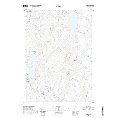
2021 Map of Readfield
USGS Topo · Published 2021About this map
Readfield and Mount Vernon anchor this landscape of the Kennebec Highlands, where the terrain is defined by a dense network of glacial lakes and family-named landmarks. The settlement of Kents Hill stands out as an educational landmark near the northern tip of Maranacook Lake, while Wings Mills sits further east along the waters of Belgrade Stream. The geography is characterized by numerous small ponds and streams, such as Hopkins Pond and Moose Pond Stream, which drain through the valleys between elevations like Hornbeam Mtn and Bowen Hill.
Find a feature on this map
96 named features on this map. Tap any name to fly to it.
Don’t see what you’re looking for? This feature index may not catch every label — zoom into the map to look around manually.
Map Details
Editions of this 2021 Readfield Map
This is the sole edition of this map. No revisions or reprints were ever made.
Other maps of this area

1892 · Augusta
USGS Topo · 1:62,500

1894 · Norridgewock
USGS Topo · 1:62,500

1898 · Norridgewock
USGS Topo · 1:62,500

1910 · Livermore
USGS Topo · 1:62,500

1912 · Livermore
USGS Topo · 1:62,500

1924 · Farmington
USGS Topo · 1:62,500

1941 · Livermore
USGS Topo · 1:62,500

1941 · Augusta
USGS Topo · 1:62,500

1943 · Augusta
USGS Topo · 1:62,500

1943 · Norridgewock
USGS Topo · 1:62,500