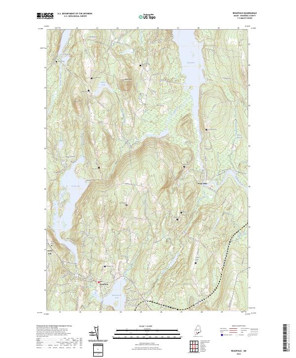
2024 Map of Readfield
USGS Topo · Published 2024About this map
Readfield sits at the northern tip of Maranacook Lake, serving as a central hub for a landscape defined by interconnected waterways and small upland settlements. The area around Kents Hill and Wings Mills is notably dense with family-named landmarks and cemeteries, reflecting generations of continuous habitation. These burial sites, such as the Philbrick Cem and Dudley Plains Cem, are scattered across the terrain from the shores of Torsey Lake to the slopes of Hornbeam Mtn.
Find a feature on this map
101 named features on this map. Tap any name to fly to it.
Don’t see what you’re looking for? This feature index may not catch every label — zoom into the map to look around manually.
Map Details
Editions of this 2024 Readfield Map
This is the sole edition of this map. No revisions or reprints were ever made.
Other maps of this area

1892 · Augusta
USGS Topo · 1:62,500

1894 · Norridgewock
USGS Topo · 1:62,500

1898 · Norridgewock
USGS Topo · 1:62,500

1910 · Livermore
USGS Topo · 1:62,500

1912 · Livermore
USGS Topo · 1:62,500

1924 · Farmington
USGS Topo · 1:62,500

1941 · Livermore
USGS Topo · 1:62,500

1941 · Augusta
USGS Topo · 1:62,500

1943 · Augusta
USGS Topo · 1:62,500

1943 · Norridgewock
USGS Topo · 1:62,500