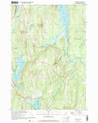
2000 Map of Readfield
USGS Topo · Published 2001About this map
Maranacook Lake and Torsey Lake anchor this study of central Maine's landscape, where the town of Readfield and the settlement at Kents Hill overlook a network of glaciated basins and ridges. The map reveals a high concentration of small family and community burial grounds, such as Robinson Cem, Philbrick Cem, and Potash Cem, which dot the rural hillsides and crossroads. Along the eastern edge, Long Pond and Belgrade Stream define the boundary near Wings Mills, a site reflecting the region's historic reliance on water power.
Find a feature on this map
68 named features on this map. Tap any name to fly to it.
Don’t see what you’re looking for? This feature index may not catch every label — zoom into the map to look around manually.
Map Details
Editions of this 2000 Readfield Map
This is the sole edition of this map. No revisions or reprints were ever made.
Other maps of this area

1892 · Augusta
USGS Topo · 1:62,500

1894 · Norridgewock
USGS Topo · 1:62,500

1898 · Norridgewock
USGS Topo · 1:62,500

1910 · Livermore
USGS Topo · 1:62,500

1912 · Livermore
USGS Topo · 1:62,500

1924 · Farmington
USGS Topo · 1:62,500

1941 · Livermore
USGS Topo · 1:62,500

1941 · Augusta
USGS Topo · 1:62,500

1943 · Augusta
USGS Topo · 1:62,500

1943 · Norridgewock
USGS Topo · 1:62,500