2023 Map of Reading
USGS Topo · Published 2023About this map
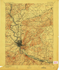
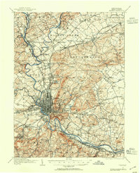
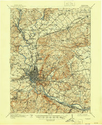
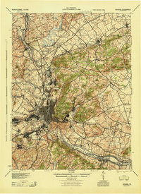
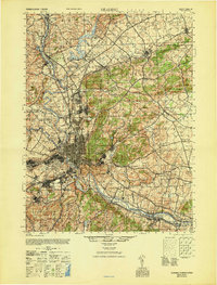
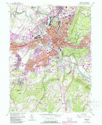
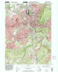
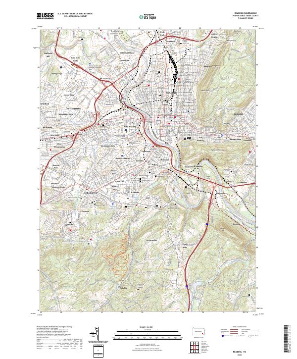
The Schuylkill River carves a deep path through the heart of this industrial and collegiate landscape, separating the dense urban grid of Reading from the borough of West Reading. This 2023 survey illustrates a complex municipal network where established centers like Shillington and Mohnton are surrounded by a diverse array of mid-century and modern residential developments such as Greenfield Manor and Montrose Manor. The region's deep cultural history is preserved in its extensive religious and civic sites, from the Welsh Baptist Meeting House Burial Ground to the Saint Nicholas Russian Orthodox Cem. Historical infrastructure is also visible along the waterway, including the Union Canal Trl and the site of Van Reeds Mill. Notable institutions like Alvernia College and Albright College anchor the residential heights, while the Reading Regional Airport/Carl A Spaatz Field occupies the northern plateau.
Find a feature on this map
139 named features on this map. Tap any name to fly to it.
Don’t see what you’re looking for? This feature index may not catch every label — zoom into the map to look around manually.
Map Details
Editions of this 2023 Reading Map
This is the sole edition of this map. No revisions or reprints were ever made.
Historical Maps of Exeter Township Through Time
9 maps found