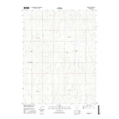
2015 Map of Reamsville
USGS Topo · Published 2015About this map
Reamsville and Thornburg anchor this rural landscape in Smith County, where the agricultural grid is defined by a dense network of sectional roads like Co RD 1553 and 60 RD. The terrain is shaped by a complex series of drainage systems, with Iowa Cr and Bull Cr flowing through the western reaches, while the eastern portion is marked by the headwaters of E Br Troublesome Cr and W Br Troublesome Cr. These small watercourses create the subtle draws and rises characteristic of the region's uplands. For those tracing local heritage, the map identifies significant landmarks including Pleasant Hill Cem near Reamsville and Eminence Cem further east. The map captures a moment in the mid-2010s where the enduring layout of family farmsteads and rural townships continues to follow the survey lines established over a century prior.
Find a feature on this map
26 named features on this map. Tap any name to fly to it.
Don’t see what you’re looking for? This feature index may not catch every label — zoom into the map to look around manually.
Map Details
Editions of this 2015 Reamsville Map
This is the sole edition of this map. No revisions or reprints were ever made.
Other maps of this area

1893 · Smith Center
USGS Topo · 1:125,000

1897 · Red Cloud
USGS Topo · 1:125,000

1940 · Red Cloud
USGS Topo · 1:62,500

1942 · Red Cloud
USGS Topo · 1:62,500

1955 · Grand Island
USGS Topo · 1:250,000

1955 · Beloit
USGS Topo · 1:250,000

1957 · Grand Island
USGS Topo · 1:250,000

1958 · Grand Island
USGS Topo · 1:250,000

1959 · Beloit
USGS Topo · 1:250,000

1973 · Athol
USGS Topo · 1:24,000