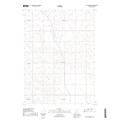
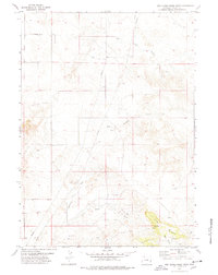
2017 Map of Red Cloud Creek East
USGS Topo · Published 2017About this map
Rawhide Creek and Sixmile Creek weave through this high plains drainage system in Goshen County, illustrating the intermittent hydrology of eastern Wyoming. This 2017 edition by the U.S. Geological Survey captures a landscape defined by ranching and rural transit, where local thoroughfares like Rd 25 and Rd 106 navigate the elevation changes between creek beds and ridge lines. The terrain is notably marked by the convergence of several drainages, including Red Cloud Creek and Dry Rawhide Creek, which carve distinct patterns into the underlying geology. For researchers and historians, the map's preservation of the Public Land Survey System (PLSS) grid, spanning multiple townships like t27n r62w, provides the essential framework for tracing property boundaries and land use in this sparsely populated area.
Find a feature on this map
12 named features on this map. Tap any name to fly to it.
Don’t see what you’re looking for? This feature index may not catch every label — zoom into the map to look around manually.
Map Details
Editions of this 2017 Red Cloud Creek East Map
This is the sole edition of this map. No revisions or reprints were ever made.
Other maps of this area

1896 · Patrick
USGS Topo · 1:125,000

1954 · Torrington
USGS Topo · 1:250,000

1958 · Torrington
USGS Topo · 1:250,000
1960 · Barnes
USGS Topo · 1:24,000
1963 · Lingle
USGS Topo · 1:24,000

1963 · Tea Kettle Rock
USGS Topo · 1:24,000

1974 · Spoon Butte SW
USGS Topo · 1:24,000
1974 · Jay Em NW
USGS Topo · 1:24,000

1974 · Jay Em
USGS Topo · 1:24,000
1977 · Red Cloud Creek West
USGS Topo · 1:24,000