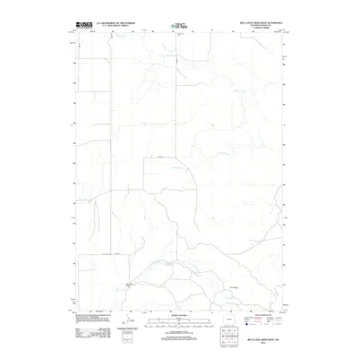
2012 Map of Red Cloud Creek West
USGS Topo · Published 2012About this map
Red Cloud Cem stands near the northern boundary of this high plains landscape, a primary landmark for genealogists tracing local families. The drainage patterns of Red Cloud Cr and Dry Rawhide Cr dictate the layout of the rural road network, which includes the historically significant Fort Laramie Rd passing through the southern reaches. The terrain transitions into the distinct topography of Pine Ridge, where Pine Ridge Cr flows through the breaks toward Dickerson Draw. This area represents the open range character of Goshen County, where water features like Skinner Reservoir provide essential points of orientation amidst the section lines and grazing lands of the early twenty-first century.
Find a feature on this map
12 named features on this map. Tap any name to fly to it.
Don’t see what you’re looking for? This feature index may not catch every label — zoom into the map to look around manually.
Map Details
Editions of this 2012 Red Cloud Creek West Map
This is the sole edition of this map. No revisions or reprints were ever made.
Other maps of this area

1896 · Patrick
USGS Topo · 1:125,000

1896 · Hartville
USGS Topo · 1:125,000

1901 · Hartville
USGS Topo · 1:125,000

1950 · Casebier Hill
USGS Topo · 1:24,000

1950 · Fort Laramie
USGS Topo · 1:24,000

1951 · Moore Spring
USGS Topo · 1:24,000

1952 · Fort Laramie
USGS Topo · 1:24,000

1954 · Torrington
USGS Topo · 1:250,000

1958 · Torrington
USGS Topo · 1:250,000
1960 · Barnes
USGS Topo · 1:24,000