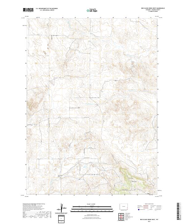
2021 Map of Red Cloud Creek West
USGS Topo · Published 2021About this map
Pine Ridge stretches across the southern reaches of this Goshen County landscape, where the high plains meet a network of deep-cut drainages. The area is defined by its seasonal watercourses and topographic relief, notably where Spring Canyon and Willy Draw carve through the terrain south of the ridge line. Significant ranching and transit history is reflected in the naming of local landmarks such as Skinner Reservoir and Dickerson Draw, while the presence of the historic Oregon Trl alignment highlights the region's enduring importance as a corridor for western migration. The northern half of the sheet is dominated by the winding paths of Red Cloud Cr and Dry Rawhide Cr, illustrating the complex hydrological pattern of this semi-arid high country during the early twenty-first century.
Find a feature on this map
31 named features on this map. Tap any name to fly to it.
Don’t see what you’re looking for? This feature index may not catch every label — zoom into the map to look around manually.
Map Details
Editions of this 2021 Red Cloud Creek West Map
This is the sole edition of this map. No revisions or reprints were ever made.
Other maps of this area

1896 · Patrick
USGS Topo · 1:125,000

1896 · Hartville
USGS Topo · 1:125,000

1901 · Hartville
USGS Topo · 1:125,000

1950 · Casebier Hill
USGS Topo · 1:24,000

1950 · Fort Laramie
USGS Topo · 1:24,000

1951 · Moore Spring
USGS Topo · 1:24,000

1952 · Fort Laramie
USGS Topo · 1:24,000

1954 · Torrington
USGS Topo · 1:250,000

1958 · Torrington
USGS Topo · 1:250,000
1960 · Barnes
USGS Topo · 1:24,000