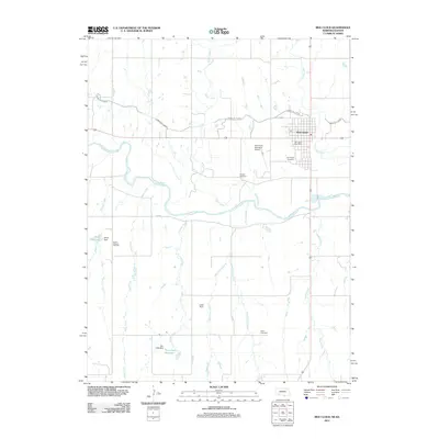
2011 Map of Red Cloud
USGS Topo · Published 2011About this map
The Republican River divides this South Central Nebraska landscape, where the town of Red Cloud serves as a primary hub of settlement and infrastructure. As a modern 2011 survey, it illustrates the critical role of water management in the region, featuring the irrigation-focused Franklin Canal and several water storage sites including Sibert Reservoir and Twin Oaks Reservoir. The town itself is well-defined, containing the Red Cloud Post Office and providing access to the Red Cloud Municipal Airport. Local genealogists will find several burial grounds across the rural terrain, including Red Cloud Cemetery, Murphy Cemetery, Mount Pleasant Cemetery, and Gust Cemetery. The map also traces various natural drainages like Indian Creek, Penny Creek, and Cedar Creek, which feed into the main river valley.
Find a feature on this map
25 named features on this map. Tap any name to fly to it.
Don’t see what you’re looking for? This feature index may not catch every label — zoom into the map to look around manually.
Map Details
Editions of this 2011 Red Cloud Map
This is the sole edition of this map. No revisions or reprints were ever made.
Other maps of this area

1893 · Smith Center
USGS Topo · 1:125,000

1894 · Mankato
USGS Topo · 1:125,000

1897 · Red Cloud
USGS Topo · 1:125,000

1898 · Superior
USGS Topo · 1:125,000

1940 · Red Cloud
USGS Topo · 1:62,500

1942 · Red Cloud
USGS Topo · 1:62,500

1955 · Grand Island
USGS Topo · 1:250,000

1955 · Beloit
USGS Topo · 1:250,000

1957 · Grand Island
USGS Topo · 1:250,000

1958 · Grand Island
USGS Topo · 1:250,000