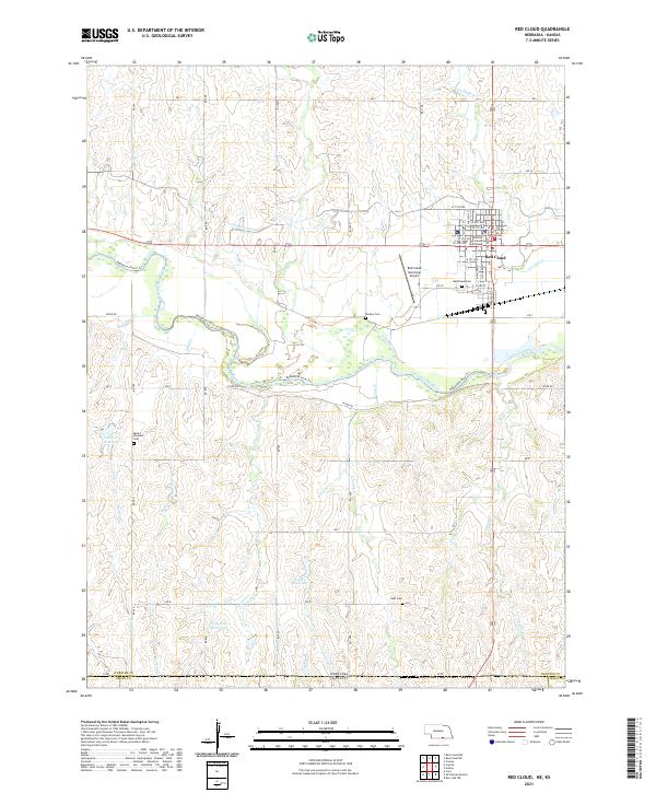
2021 Map of Red Cloud
USGS Topo · Published 2021About this map
Red Cloud serves as the focal point of this South Central Nebraska landscape, situated just north of the Republican River. As the county seat of Webster County, the town's grid is anchored by the Webster County Courthouse and a series of named streets including N Webster St and W 4th Ave. The terrain is defined by the river's broad valley and a network of drainages like Indian Creek and Cedar Creek, which feed into the main waterway. Local irrigation and water management are evident through the Franklin Canal and several upland impoundments such as Lewis Reservoir and Sibert Reservoir. The rural surrounding areas are dotted with community landmarks that provide significant value for genealogical research, including the Red Cloud Cemetery, Murphy Cemetery, and Mount Pleasant Cemetery.
Find a feature on this map
59 named features on this map. Tap any name to fly to it.
Don’t see what you’re looking for? This feature index may not catch every label — zoom into the map to look around manually.
Map Details
Editions of this 2021 Red Cloud Map
This is the sole edition of this map. No revisions or reprints were ever made.
Other maps of this area

1893 · Smith Center
USGS Topo · 1:125,000

1894 · Mankato
USGS Topo · 1:125,000

1897 · Red Cloud
USGS Topo · 1:125,000

1898 · Superior
USGS Topo · 1:125,000

1940 · Red Cloud
USGS Topo · 1:62,500

1942 · Red Cloud
USGS Topo · 1:62,500

1955 · Grand Island
USGS Topo · 1:250,000

1955 · Beloit
USGS Topo · 1:250,000

1957 · Grand Island
USGS Topo · 1:250,000

1958 · Grand Island
USGS Topo · 1:250,000