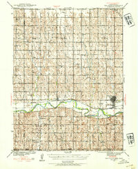
1940 Map of Red Cloud
USGS Topo · Published 1954About this map
The Republican River valley serves as the central artery for this south-central Nebraska landscape, where the Chicago Burlington and Quincy railroad tracks parallel the water through Red Cloud and Inavale. The grid-patterned township system is densely punctuated by rural community infrastructure, including an unusually high concentration of one-room schoolhouses such as Line Tree Sch, Pleasant Prairie Sch, and the Poor Farm Sch.
Find a feature on this map
50 named features on this map. Tap any name to fly to it.
Don’t see what you’re looking for? This feature index may not catch every label — zoom into the map to look around manually.
Map Details
Editions of this 1940 Red Cloud Map
2 editions found
Other maps of this area

1893 · Smith Center
USGS Topo · 1:125,000

1894 · Mankato
USGS Topo · 1:125,000

1897 · Red Cloud
USGS Topo · 1:125,000

1898 · Superior
USGS Topo · 1:125,000

1940 · Red Cloud
USGS Topo · 1:62,500

1942 · Red Cloud
USGS Topo · 1:62,500

1955 · Grand Island
USGS Topo · 1:250,000

1955 · Beloit
USGS Topo · 1:250,000

1957 · Grand Island
USGS Topo · 1:250,000

1958 · Grand Island
USGS Topo · 1:250,000