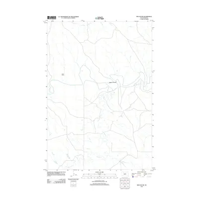
2012 Map of Red Elm NW
USGS Topo · Published 2012About this map
Moreau River meanders across this northern Ziebach County landscape, serving as a primary geographical anchor for the surrounding prairie. This area, documented in 2012, is defined by the significant drainage network of Flint Rock Cr and Knocker Cr, which shape the local topography. A notable point of human interface with the river is found at Allison Crossing, a location that marks the intersection of the waterway and local travel routes. The terrain includes distinctive features such as Sand Draw and the tributary Locate Cr, illustrating the water-sculpted character of the northern South Dakota plains. The map provides a detailed view of the rural road network that connects isolated ranchlands and crossing points within this expanse of the Great Plains.
Find a feature on this map
6 named features on this map. Tap any name to fly to it.
Don’t see what you’re looking for? This feature index may not catch every label — zoom into the map to look around manually.
Map Details
Editions of this 2012 Red Elm NW Map
This is the sole edition of this map. No revisions or reprints were ever made.
Other maps of this area

1951 · Redelm NE
USGS Topo · 1:24,000

1951 · Redelm NW
USGS Topo · 1:24,000

1951 · Faith NE
USGS Topo · 1:24,000

1953 · McIntosh
USGS Topo · 1:250,000

1954 · Lemmon
USGS Topo · 1:250,000

1957 · Lemmon
USGS Topo · 1:250,000

1958 · McIntosh
USGS Topo · 1:250,000

1982 · Glad Valley SW
USGS Topo · 1:24,000
1982 · Red Elm
USGS Topo · 1:24,000

1982 · Glad Valley SE
USGS Topo · 1:24,000