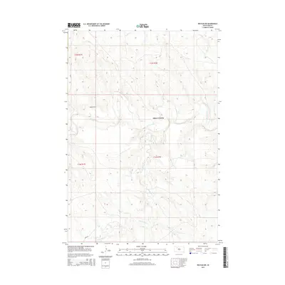
2015 Map of Red Elm NW
USGS Topo · Published 2015About this map
Allison Crossing serves as a central point of reference in this landscape of the Cheyenne River Reservation, where the Moreau River meanders through Ziebach County. The terrain is defined by a network of drainage systems, including Flint Rock Cr and Locate Cr, which flow through the rolling grasslands. The absence of densely clustered settlements highlights the ranching and agricultural character of the region, where movement is facilitated by a grid of rural roads like 202nd Ave. The intricate contour lines illustrate the intricate breaks and coulees common to this part of South Dakota, particularly around the northern reaches of Knocker Cr and the wide drainage of Sand Draw. These natural features have historically dictated the placement of crossings and early trail routes through the western plains.
Find a feature on this map
11 named features on this map. Tap any name to fly to it.
Don’t see what you’re looking for? This feature index may not catch every label — zoom into the map to look around manually.
Map Details
Editions of this 2015 Red Elm NW Map
This is the sole edition of this map. No revisions or reprints were ever made.
Other maps of this area

1951 · Redelm NE
USGS Topo · 1:24,000

1951 · Redelm NW
USGS Topo · 1:24,000

1951 · Faith NE
USGS Topo · 1:24,000

1953 · McIntosh
USGS Topo · 1:250,000

1954 · Lemmon
USGS Topo · 1:250,000

1957 · Lemmon
USGS Topo · 1:250,000

1958 · McIntosh
USGS Topo · 1:250,000

1982 · Glad Valley SW
USGS Topo · 1:24,000
1982 · Red Elm
USGS Topo · 1:24,000

1982 · Glad Valley SE
USGS Topo · 1:24,000