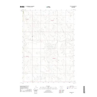
2017 Map of Red Elm NW
USGS Topo · Published 2017About this map
The Moreau River defines this portion of Ziebach County, winding through the High Plains as it carves a distinct valley through the prairie. This 2017 survey documents a largely unpopulated landscape within the Cheyenne River Indian Reservation, where the drainage patterns of Flint Rock Cr and Knocker Cr shape the topography. The presence of the Sand Draw indicates the seasonal shifts in water flow and the geomorphology of the Missouri Plateau region. While contemporary in its mapping standards, the sheet illustrates the enduring character of this rural ranching country, showing how the natural hydrology still dictates the routes and boundaries of the West River area.
Find a feature on this map
5 named features on this map. Tap any name to fly to it.
Don’t see what you’re looking for? This feature index may not catch every label — zoom into the map to look around manually.
Map Details
Editions of this 2017 Red Elm NW Map
This is the sole edition of this map. No revisions or reprints were ever made.
Other maps of this area

1951 · Redelm NE
USGS Topo · 1:24,000

1951 · Redelm NW
USGS Topo · 1:24,000

1951 · Faith NE
USGS Topo · 1:24,000

1953 · McIntosh
USGS Topo · 1:250,000

1954 · Lemmon
USGS Topo · 1:250,000

1957 · Lemmon
USGS Topo · 1:250,000

1958 · McIntosh
USGS Topo · 1:250,000

1982 · Glad Valley SW
USGS Topo · 1:24,000
1982 · Red Elm
USGS Topo · 1:24,000

1982 · Glad Valley SE
USGS Topo · 1:24,000