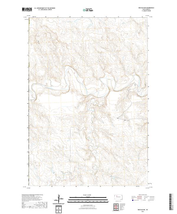
2021 Map of Red Elm NW
USGS Topo · Published 2021About this map
The Moreau River meanders through the heart of this central South Dakota landscape, defining the topography of Ziebach County. The drainage network is complex, with Flint Rock Cr and Knocker Cr cutting through the dissected plains, while Sand Draw and Locate Cr mark the western reaches of this area. These waterways create a distinct erosion pattern across the western Dakotas, illustrating the natural landforms that have dictated ranching boundaries and transportation routes since the early days of settlement. The map provides precise detail on the Public Land Survey System (PLSS) grid, showing the boundaries between Township 15 North, Range 18 East and adjacent survey blocks, which remains essential for local land records and historical research into the region's homesteading layout.
Find a feature on this map
10 named features on this map. Tap any name to fly to it.
Don’t see what you’re looking for? This feature index may not catch every label — zoom into the map to look around manually.
Map Details
Editions of this 2021 Red Elm NW Map
This is the sole edition of this map. No revisions or reprints were ever made.
Other maps of this area

1951 · Redelm NE
USGS Topo · 1:24,000

1951 · Redelm NW
USGS Topo · 1:24,000

1951 · Faith NE
USGS Topo · 1:24,000

1953 · McIntosh
USGS Topo · 1:250,000

1954 · Lemmon
USGS Topo · 1:250,000

1957 · Lemmon
USGS Topo · 1:250,000

1958 · McIntosh
USGS Topo · 1:250,000

1982 · Glad Valley SW
USGS Topo · 1:24,000
1982 · Red Elm
USGS Topo · 1:24,000

1982 · Glad Valley SE
USGS Topo · 1:24,000