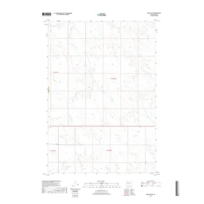
2017 Map of Red Elm SW
USGS Topo · Published 2017About this map
S Fork Flint Rock Cr winds through this section of Ziebach County, defining a landscape of high plains drainage just south of the main Flint Rock Cr. The terrain is marked by the rectilinear grid of the Public Land Survey System, specifically within the townships of t13n r17e, t13n r18e, t12n r17e, and t12n r18e. This 2017 survey captures the area in a modern era where infrastructure is sparse, primarily consisting of section-line roads like 164th St. In the southern portion of the map, Red Coat Cr emerges, flowing eastward through the open range. The drainage patterns of these creeks illustrate the subtle topography of the Cheyenne River watershed area, providing a precise look at the seasonal watercourses and local section boundaries used by ranchers and land managers.
Find a feature on this map
9 named features on this map. Tap any name to fly to it.
Don’t see what you’re looking for? This feature index may not catch every label — zoom into the map to look around manually.
Map Details
Editions of this 2017 Red Elm SW Map
This is the sole edition of this map. No revisions or reprints were ever made.
Other maps of this area

1951 · Redelm NE
USGS Topo · 1:24,000

1951 · Redelm NW
USGS Topo · 1:24,000

1951 · Faith NE
USGS Topo · 1:24,000

1953 · Rapid City
USGS Topo · 1:250,000

1953 · McIntosh
USGS Topo · 1:250,000

1954 · Lemmon
USGS Topo · 1:250,000

1954 · Pierre
USGS Topo · 1:250,000

1957 · Lemmon
USGS Topo · 1:250,000

1957 · Rapid City
USGS Topo · 1:250,000

1958 · Pierre
USGS Topo · 1:250,000