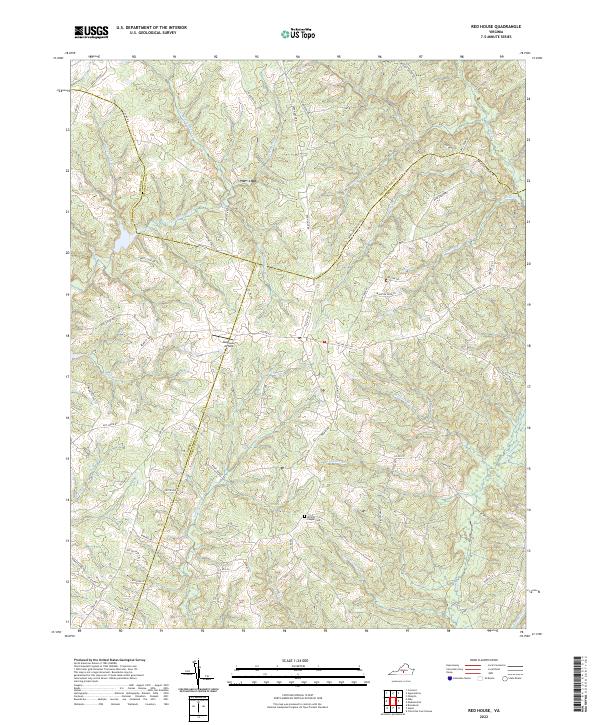
2022 Map of Red House
USGS Topo · Published 2022About this map
The rolling countryside of central Virginia is defined by a dense network of watercourses at the junction of Appomattox, Campbell, and Charlotte counties. The landscape is characterized by a high concentration of small tributaries like Marrowbone Creek and Little Falling River, which feed into the larger drainage systems of the Piedmont. This region maintains a strong agricultural and rural character, evidenced by the numerous farm-to-market roads and the presence of the Redhouse Airfield nestled among the winding ridges. Family history is anchored by landmarks such as Whites Chapel Cemetery and a series of roads reflecting local landownership and industry, including Thorntons Mill Road and Marston Farm Lane. The intricate topography of the area, marked by features like Steele Fork and Madison Mill Branch, highlights a traditional Southern landscape of dispersed homesteads and small-scale aviation.
Find a feature on this map
73 named features on this map. Tap any name to fly to it.
Don’t see what you’re looking for? This feature index may not catch every label — zoom into the map to look around manually.
Map Details
Editions of this 2022 Red House Map
This is the sole edition of this map. No revisions or reprints were ever made.
Other maps of this area

1892 · Appomattox
USGS Topo · 1:125,000

1947 · Roanoke
USGS Topo · 1:250,000

1956 · Brookneal
USGS Topo · 1:62,500

1956 · Charlotte Court House
USGS Topo · 1:62,500

1958 · Appomattox
USGS Topo · 1:62,500

1958 · Pamplin City
USGS Topo · 1:62,500

1959 · Roanoke
USGS Topo · 1:250,000

1963 · Roanoke
USGS Topo · 1:250,000
1966 · Mike
USGS Topo · 1:24,000
1966 · Brookneal
USGS Topo · 1:24,000