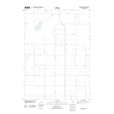
2012 Map of Red Lake East
USGS Topo · Published 2012About this map
Red Lake and the meandering course of Nelson Cr define this rural South Dakota landscape in Brule County. This 2012 survey illustrates a classic Midwestern township grid, where numbered avenues and streets segment the agricultural terrain into precise squares. Near the center of this grid sits the Lutheran Cem, a small but significant site for family historians and genealogists researching the local area. The water management of the region is evident in the presence of Ranzour Dam to the south, while Reimer Cr flows along the western edge. This map documents a period of stable land use, highlighting the persistence of small-scale water features and local landmarks within the expansive prairie environment of Smith Township.
Find a feature on this map
19 named features on this map. Tap any name to fly to it.
Don’t see what you’re looking for? This feature index may not catch every label — zoom into the map to look around manually.
Map Details
Editions of this 2012 Red Lake East Map
This is the sole edition of this map. No revisions or reprints were ever made.
Other maps of this area

1935 · Chamberlain
USGS Topo · 1:62,500

1939 · Chamberlain
USGS Topo · 1:62,500

1940 · Iona
USGS Topo · 1:62,500

1941 · Pukwana
USGS Topo · 1:62,500

1944 · Iona
USGS Topo · 1:62,500

1951 · Pukwana
USGS Topo · 1:62,500

1955 · Mitchell
USGS Topo · 1:250,000

1959 · Mitchell
USGS Topo · 1:250,000
1974 · Bond Bottom
USGS Topo · 1:24,000

1974 · Red Lake West
USGS Topo · 1:24,000