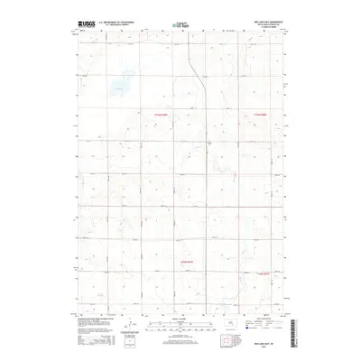
2015 Map of Red Lake East
USGS Topo · Published 2015About this map
Red Lake and the smaller basin of Lake Wanalain anchor the drainages of this South Dakota landscape, where the prairie is dissected by the meandering courses of Nelson Cr and Reimer Cr. The section-line road grid, defined by routes like 254th St and 350th Ave, organizes the territory into a rhythmic pattern of agricultural parcels. Local history is anchored at the Lutheran Cem, a quiet landmark positioned near the center of the survey area. In the southern reaches, the Panzour Dam across a tributary of Nelson Creek illustrates the regional management of water resources in this part of Brule County. The topography reveals a series of subtle rises and depressions typical of the Missouri Plateau, showing how contemporary infrastructure follows the established townships of t103n r70w and surrounding ranges.
Find a feature on this map
24 named features on this map. Tap any name to fly to it.
Don’t see what you’re looking for? This feature index may not catch every label — zoom into the map to look around manually.
Map Details
Editions of this 2015 Red Lake East Map
This is the sole edition of this map. No revisions or reprints were ever made.
Other maps of this area

1935 · Chamberlain
USGS Topo · 1:62,500

1939 · Chamberlain
USGS Topo · 1:62,500

1940 · Iona
USGS Topo · 1:62,500

1941 · Pukwana
USGS Topo · 1:62,500

1944 · Iona
USGS Topo · 1:62,500

1951 · Pukwana
USGS Topo · 1:62,500

1955 · Mitchell
USGS Topo · 1:250,000

1959 · Mitchell
USGS Topo · 1:250,000
1974 · Bond Bottom
USGS Topo · 1:24,000

1974 · Red Lake West
USGS Topo · 1:24,000