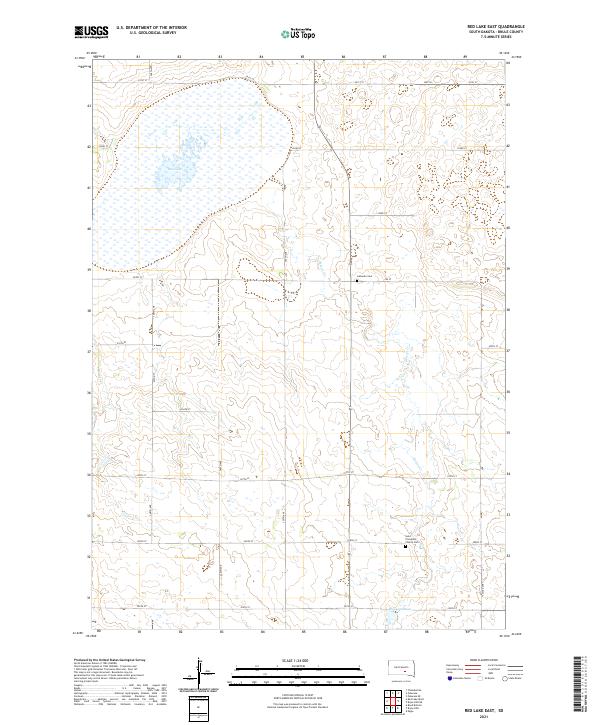
2021 Map of Red Lake East
USGS Topo · Published 2021About this map
The expansive waters of Red Lake dominate the northern prairie of Brule County in this 2021 survey. This portion of South Dakota is defined by its rectilinear section lines and a drainage system that includes Nelson Cr and Reimer Cr, which cut through the undulating landscape toward the south. The agricultural character of the region is punctuated by long-standing community landmarks that serve as vital links for local genealogists. Lutheran Cem sits adjacent to the meandering course of Nelson Creek, while further south, Saint Procopius Church Cem remains a significant anchor for the rural township. Modern infrastructure is represented by Hwy 50 and a network of gravel section roads like 348th Ave, while the presence of Bonzow Dam indicates the managed water resources essential to this plains environment.
Find a feature on this map
26 named features on this map. Tap any name to fly to it.
Don’t see what you’re looking for? This feature index may not catch every label — zoom into the map to look around manually.
Map Details
Editions of this 2021 Red Lake East Map
This is the sole edition of this map. No revisions or reprints were ever made.
Other maps of this area

1935 · Chamberlain
USGS Topo · 1:62,500

1939 · Chamberlain
USGS Topo · 1:62,500

1940 · Iona
USGS Topo · 1:62,500

1941 · Pukwana
USGS Topo · 1:62,500

1944 · Iona
USGS Topo · 1:62,500

1951 · Pukwana
USGS Topo · 1:62,500

1955 · Mitchell
USGS Topo · 1:250,000

1959 · Mitchell
USGS Topo · 1:250,000
1974 · Bond Bottom
USGS Topo · 1:24,000

1974 · Red Lake West
USGS Topo · 1:24,000