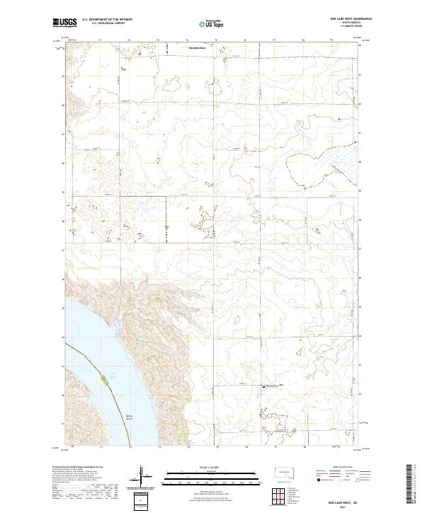
2021 Map of Red Lake West
USGS Topo · Published 2021About this map
Lake Francis Case dominates the southwestern corner of this landscape, its waters contained by the rugged bluffs of the Missouri River valley. The terrain here transitions sharply from the high, flat prairie of the northern plains into the deeply eroded breaks and coulees that lead down to the reservoir. While the settlement of Chamberlain is visible along the northern edge of the sheet, much of the surrounding area is defined by the grid of rural township roads and agricultural sections characteristic of the central South Dakota plateau. The map captures the topography of this river corridor in detail, highlighting the contrast between the stabilized water level of the artificial lake and the ancient, dissected landforms of the Brule County shoreline.
Find a feature on this map
2 named features on this map. Tap any name to fly to it.
Don’t see what you’re looking for? This feature index may not catch every label — zoom into the map to look around manually.
Map Details
Editions of this 2021 Red Lake West Map
This is the sole edition of this map. No revisions or reprints were ever made.
Other maps of this area

1935 · Chamberlain
USGS Topo · 1:62,500

1939 · Chamberlain
USGS Topo · 1:62,500

1940 · Iona
USGS Topo · 1:62,500

1941 · Pukwana
USGS Topo · 1:62,500

1944 · Iona
USGS Topo · 1:62,500

1951 · Pukwana
USGS Topo · 1:62,500

1952 · Oacoma
USGS Topo · 1:24,000

1952 · Iona NW
USGS Topo · 1:24,000

1955 · Mitchell
USGS Topo · 1:250,000

1959 · Mitchell
USGS Topo · 1:250,000