
1952 Map of Oacoma
USGS Topo · Published 1954About this map
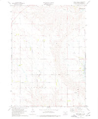
Missouri River and White River bottomlands define the landscape of this mid-century survey, captured just as the Missouri River Basin development program began to reshape the region. The map provides critical data for the forthcoming Fort Randall Reservoir, with dashed blue lines indicating areas destined to be submerged at the 1375-foot elevation mark. This includes the riverbed surrounding Bice Island and Bird Island. The town of Oacoma is a focal point, situated at the junction of the Chicago Milwaukee St Paul and Pacific railroad and the river crossing. Local land use is documented through several named agricultural properties, such as Sharp Ranch, Lindly Ranch, and Reese Ranch. Other landmarks include the Oacoma Cem and an Inactive Mine, while the winding courses of American Crow Creek and Big Creek cut through the breaks above the river valley.
Find a feature on this map
25 named features on this map. Tap any name to fly to it.
Don’t see what you’re looking for? This feature index may not catch every label — zoom into the map to look around manually.
Map Details
Editions of this 1952 Oacoma Map
This is the sole edition of this map. No revisions or reprints were ever made.
Other maps of this area

1935 · Chamberlain
USGS Topo · 1:62,500

1939 · Chamberlain
USGS Topo · 1:62,500

1940 · Iona
USGS Topo · 1:62,500

1944 · Iona
USGS Topo · 1:62,500

1952 · Reliance SE
USGS Topo · 1:24,000

1952 · Hamill NE
USGS Topo · 1:24,000

1952 · Iona NW
USGS Topo · 1:24,000

1955 · Mitchell
USGS Topo · 1:250,000

1959 · Mitchell
USGS Topo · 1:250,000
1974 · Short Creek
USGS Topo · 1:24,000