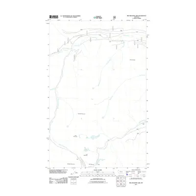
2011 Map of Red Meadow Lake
USGS Topo · Published 2011About this map
Nasukoin Mountain and Akinkoka Peak dominate this high-elevation landscape in Flathead County, defined by a complex network of drainage basins and forest service infrastructure. The northern portion of the map is centered on the Whale Creek corridor, where the Whale Creek Falls marks a significant hydrological transition. Transportation is limited to specialized routes such as Natl Forest Develop Road 1674 Rd and Whale Creek Rd, reflecting the area's primary use for forest management and resource access.
Find a feature on this map
21 named features on this map. Tap any name to fly to it.
Don’t see what you’re looking for? This feature index may not catch every label — zoom into the map to look around manually.
Map Details
Editions of this 2011 Red Meadow Lake Map
This is the sole edition of this map. No revisions or reprints were ever made.
Other maps of this area

1906 · Kintla Lakes
USGS Topo · 1:125,000

1913 · Stryker
USGS Topo · 1:125,000

1916 · Stryker
USGS Topo · 1:125,000

1938 · Kintla Lakes
USGS Topo · 1:125,000

1957 · Kalispell
USGS Topo · 1:250,000

1960 · Kalispell
USGS Topo · 1:250,000

1961 · Kalispell
USGS Topo · 1:250,000

1966 · Red Meadow Lake
USGS Topo · 1:24,000
1966 · Bull Lake
USGS Topo · 1:24,000

1966 · Mount Hefty
USGS Topo · 1:24,000