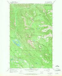
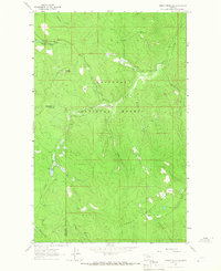
1966 Map of Bull Lake
USGS Topo · Published 1971About this map
The Stillwater River winds through this mid-1960s terrain, marking the boundary between Lincoln Co and Flathead Co. This is a landscape of profound topographical relief, dominated by the massif of Herrig Mountain and the high summit of Stryker Pk. The southern portion of the sheet is defined by the Great Northern rail corridor, which follows the river valley past Point of Rocks and the Sunday Lakes. A distinct network of alpine waters including Bull Lake, Fish Lake, and Herrig Lake are concentrated within the Stillwater State Forest and surrounding national forest lands. The presence of a Radio Tower on a remote ridge and a Gravel Pit near Duck Lake indicate the light infrastructure supporting this timber and mountain wilderness just before the modern era of backcountry management.
Find a feature on this map
29 named features on this map. Tap any name to fly to it.
Don’t see what you’re looking for? This feature index may not catch every label — zoom into the map to look around manually.
Map Details
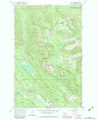
Editions of this 1966 Bull Lake Map
2 editions found
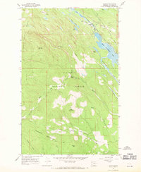
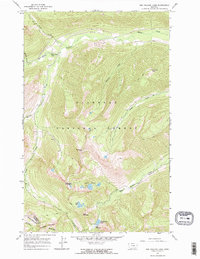
Other maps of this area

1913 · Stryker
USGS Topo · 1:125,000

1916 · Stryker
USGS Topo · 1:125,000

1957 · Kalispell
USGS Topo · 1:250,000

1960 · Kalispell
USGS Topo · 1:250,000

1961 · Kalispell
USGS Topo · 1:250,000
1963 · Mount Marston
USGS Topo · 1:24,000
1963 · Stryker
USGS Topo · 1:24,000
1963 · Sunday Mountain
USGS Topo · 1:24,000
1966 · Radnor
USGS Topo · 1:24,000
1966 · Red Meadow Lake
USGS Topo · 1:24,000