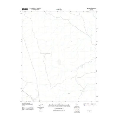
2011 Map of Red Mesa
USGS Topo · Published 2011About this map
Red Mesa dominates this high-desert landscape in Yavapai County, where the topography is defined by the ephemeral drainage of Chino Wash. This 2011 survey illustrates a sparse ranching or grazing environment where water management is paramount, evidenced by a network of named stock tanks scattered across the terrain. These include Larson Tank, Burro Tank, and Black Mountain Tank, which collect seasonal runoff for livestock. Modern infrastructure is limited to the southwest corner, where the straight line of Railroad Ave provides a rare corridor of transport through the arid flats. The map reflects the persistent importance of named water sources like Caterpillar Tank and Chino Tank in an area where permanent natural water is absent.
Find a feature on this map
11 named features on this map. Tap any name to fly to it.
Don’t see what you’re looking for? This feature index may not catch every label — zoom into the map to look around manually.
Map Details
Editions of this 2011 Red Mesa Map
This is the sole edition of this map. No revisions or reprints were ever made.
Other maps of this area

1886 · Diamond Creek
USGS Topo · 1:250,000

1886 · Chino
USGS Topo · 1:250,000

1891 · Chino
USGS Topo · 1:250,000

1892 · Diamond Creek
USGS Topo · 1:250,000

1948 · Williams
USGS Topo · 1:250,000

1954 · Williams
USGS Topo · 1:250,000

1956 · Williams
USGS Topo · 1:250,000

1960 · Williams
USGS Topo · 1:250,000

1961 · Williams
USGS Topo · 1:250,000
1980 · Audley
USGS Topo · 1:24,000