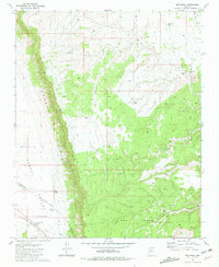
1981 Map of Red Mesa
USGS Topo · Published 1981About this map
The Aubrey Cliffs dominate the western portion of this Arizona landscape, creating a sharp topographic break between the high desert of Red Mesa and the expansive Aubrey Valley below. This 1981 record captures a transition zone where the Atchison Topeka and Santa Fe railroad cuts across the southwestern corner, providing a vital transportation link through the arid terrain.
Find a feature on this map
21 named features on this map. Tap any name to fly to it.
Don’t see what you’re looking for? This feature index may not catch every label — zoom into the map to look around manually.
Map Details
Editions of this 1981 Red Mesa Map
2 editions found
Other maps of this area

1886 · Diamond Creek
USGS Topo · 1:250,000

1886 · Chino
USGS Topo · 1:250,000

1891 · Chino
USGS Topo · 1:250,000

1892 · Diamond Creek
USGS Topo · 1:250,000

1948 · Williams
USGS Topo · 1:250,000

1954 · Williams
USGS Topo · 1:250,000

1956 · Williams
USGS Topo · 1:250,000

1960 · Williams
USGS Topo · 1:250,000

1961 · Williams
USGS Topo · 1:250,000
1980 · Audley
USGS Topo · 1:24,000