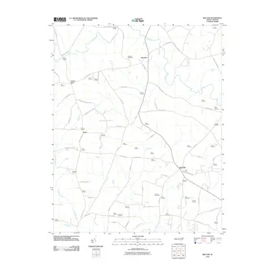
2010 Map of Red Oak
USGS Topo · Published 2010About this map
Red Oak serves as a central hub for this rural portion of Nash County, where a dense network of family-named cemeteries and crossroads settlements defines the local landscape. The map reveals the intricate drainage patterns of Sandy Creek, Swift Creek, and Pig Basket Creek, which are punctuated by engineered landmarks like the Coopers Pond Dam and Collins Pond Dam. A high concentration of family burial grounds, including the Boseman Cemetery, Arrington Cemetery, and Hedgepeth Cemetery, indicates deep generational roots across this agricultural region. Historic routes like Wheeles Cabin Rd and Taylors Store Rd connect scattered outposts such as Taylors Store and Hilliardston, providing a detailed look at the rural infrastructure and land divisions that have persisted into the twenty-first century.
Find a feature on this map
81 named features on this map. Tap any name to fly to it.
Don’t see what you’re looking for? This feature index may not catch every label — zoom into the map to look around manually.
Map Details
Editions of this 2010 Red Oak Map
This is the sole edition of this map. No revisions or reprints were ever made.
Other maps of this area

1902 · Rocky Mount
USGS Topo · 1:62,500

1902 · Spring Hope
USGS Topo · 1:62,500

1904 · Rocky Mount
USGS Topo · 1:62,500

1904 · Springhope
USGS Topo · 1:62,500

1953 · Norfolk
USGS Topo · 1:250,000

1953 · Rocky Mount
USGS Topo · 1:250,000

1953 · Raleigh
USGS Topo · 1:250,000

1953 · Greensboro
USGS Topo · 1:250,000

1954 · Greensboro
USGS Topo · 1:250,000

1954 · Rocky Mount
USGS Topo · 1:250,000